Print Story
X

Subsidence and rising sea levels pose a major threat to Korangi and Landhi, Karachi’s industrial heartland
| A |
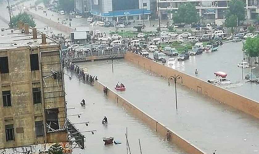
vast portion of the Indus delta, encompassing the Badin and Thatta districts and stretching to the creek areas of Korangi in Karachi, is sinking due to subsidence. Sea water incursion has rendered swathes of land uncultivable, devastated the fisheries and caused human displacement.
This double‑edged crisis—sea‑level rise coupled with alarming land subsidence—has turned the Indus delta into a ticking time bomb for millions of people that inhabit the coastal strip.
The delta’s foundation, a landscape made of soft sediments and mud, is guarded only by a fragile line of white sand dunes. These are the land’s final defence against the crashing sea waves.
This barrier of dunes is now giving way, says Dr Asif Inam, former director general of National Institute of Oceanography. “It is crumbling under severe pressure from sea erosion,” he says, “Once these dunes are gone, the ground beneath will erode, unable to hold back the waves.”
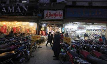
This alarming scenario is not merely an environmental concern—it translates directly into a catastrophic threat for Karachi’s Landhi and Korangi areas.
“The threat to Landhi and Korangi is alarming not only because these areas are densely-populated but also because they house industrial zones and commercial markets,” says Dr Inam.
Citing IPCC forecasts, Dr Inam says the future does not seem very promising. “Even with zero emissions, a 30 cm sea-level rise is projected by 2100. A business-as-usual approach can unleash a terrifying 70 cm rise. This looming inundation, combined with the land’s own subsidence, makes for a truly frightening scenario for Korangi, Landhi and their creeks,” he says. “If things go as they are, this entire area will be lost to the sea by the century’s end.”
The crucial urban centres are directly in the path of destruction. Both industrial localities lie perilously close to the sea level. Dr Asif Inam fears that if preventive actions are not undertaken soon they “will be initially flooded and eventually submerged by the sea.”
He explains the grim progression: “The residence period of the sea will be brief, with flooding during high tide that recedes at low tide. Eventually, it will submerge the whole area.”
Until a few decades ago, a natural shield protected the Korangi creek areas: dense mangrove forests. Their removal to make way for concrete and commerce has left the coastline unshielded.
Relocation of industrial zones and critical infrastructure is no longer a choice. It is better to start planning for this exodus now than to wait for a cataclysmic destruction.
Some nations have heeded such warnings. The Netherlands began building its dykes centuries ago to forestall a similar fate. Its famous windmills are a crucial part of the mechanism that holds the water at bay. Jakarta has effectively checked the encroaching sea in its coastal villages by replanting mangrove forests—a powerful, natural solution.
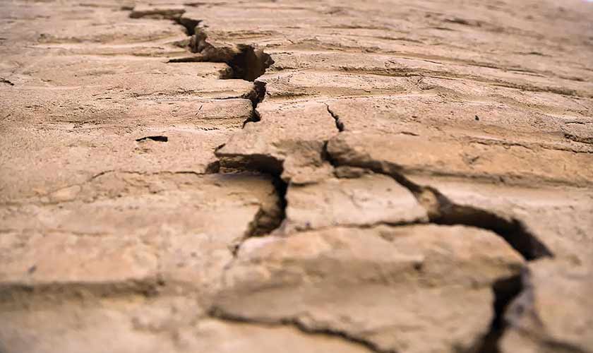
New data from European Space Agency satellites has revealed that the ground beneath Karachi is sinking rapidly, with the city’s centre being most affected. According to a paper published in the Nature in 2022, land subsidence is a major threat to buildings, roads, water and gas utility lines in Karachi.
“Even with zero emissions, a 30 cm sea-level rise is projected by 2100. A business-as-usual approach can unleash a terrifying 70 cm rise. This looming incursion, combined with the land’s own subsidence, makes for truly frightening scenarios for Korangi, Landhi and their creeks. If things go as they are, this entire area will be lost to the sea by the century’s end.”
The results are alarming. “The data shows that the ground is sinking at a rate of nearly seven centimetres (2.7 inches) a year in the worst-affected areas. This subsidence rate (68.91 mm/ year) is very high for a major urban area.”
Critically, the satellite imagery analysis shows that the ground movement is almost purely vertical sinking, with very little horizontal shifting. This pattern is a classic signature of subsidence caused by excessive groundwater extraction and the compaction of soil under the weight of heavy infrastructure. The study, which monitored the city from November 2019 to December 2020, recorded “a considerable rise in subsidence” within that single year.
Extensive development is taking place on Karachi’s coastline with beachfront lands being reclaimed for commercial projects and residential complexes. This land reclamation, combined with existing environmental challenges like coastal erosion and waterlogging, has significantly increased the likelihood of land subsidence in the metropolitan.
Karachi’s ground is sinking at alarming rates in several key areas. The vertical ground movement ranges from -67.66 mm per year to 74.68 mm per year.
While the western part of the city remains stable, several eastern and southern neighborhoods are experiencing severe subsidence. The research identified the most critical subsidence hotspots, with Radio Pakistan Colony sinking at -31.7 mm/year and the adjacent Malir area subsiding at -30.9 mm/ year. In the southern coastal sectors, DHA Karachi Phase VIII Zone B is sinking at -28.6 mm/ year while neighboring DHA Karachi Phase 4 shows -27.7 mm/ year subsidence.
Other affected areas include Sherpao Colony (-27.0 mm/ year), along with Sector 7-A and Sector 28, where the highest displacement reached -18.9 mm/ year during the study period.
“This acceleration indicates the underlying cause of commercial and domestic over-extraction of groundwater is intensifying, raising the risk of further damage.”
Karachi is facing a severe and prolonged water crisis driven by rapid population growth and mismanagement. That is why many rely on groundwater and bore for it.
This over-extraction is causing a sustained drop in Karachi’s groundwater table, that has dropped from 9 metres to 152 metres. The water level in boreholes along the Malir River, which was 6-8 metres from 1960 to 1980, has now dropped to 12-18 metres. Consequently, new wells must be drilled to greater depths to access the receding water.
This unsustainable practice has been identified as the primary cause of severe land subsidence in Karachi, particularly in areas with soft clay soil. The aggressive, commercial extraction of water is a major contributing factor to this phenomenon. This leads to ground compaction and poses a significant liquefaction risk.
To overcome this growing crisis, experts recommend cracking down on excessive groundwater pumping and ensuring thorough land surveys ahead of any new construction. This is critical to prevent further damage and protect the city’s long-term structural viability.
Karachi’s rapid and unregulated urban expansion has created the conditions for land deformation. The situation demands urgent attention because Karachi represents a classic case of unsustainable urban growth. As the city continues to expand without proper planning and regulation, the risks associated with land subsidence continue to grow.
This makes continuous monitoring and measurement of land deformation crucial for the city’s future development and safety. Strengthening coastal dunes, restoring mangroves, regulating groundwater extraction and re‑thinking development on reclaimed land are no longer optional measures—they are the only way to safeguard the city’s future.
The writer is a senior The News staffer in Karachi